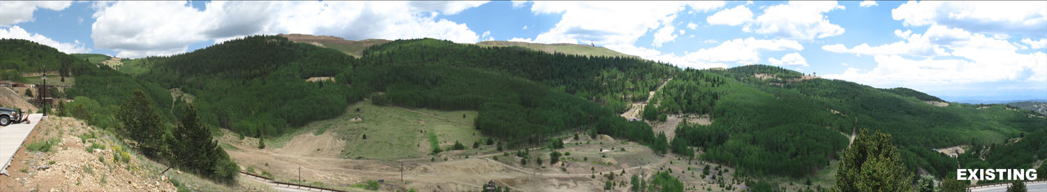
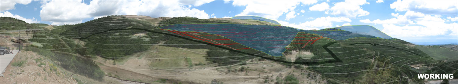
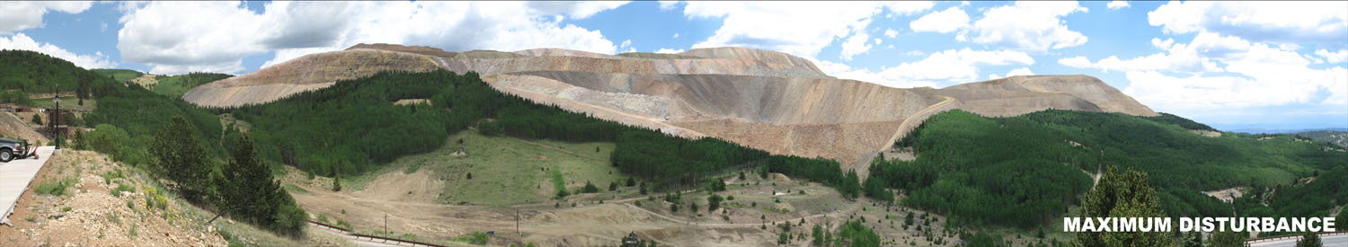
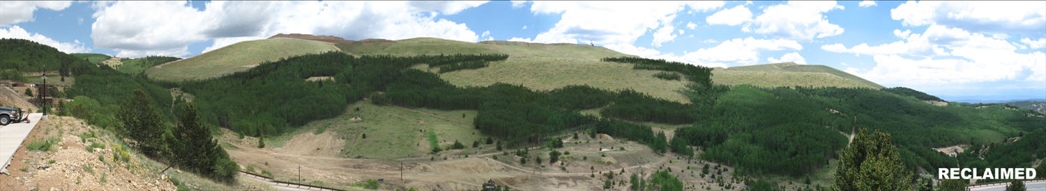
3D & Photo Simulations

3D Modeling

TGA converts 2D contours and topographical data to a 3D base on which aerials and plans can be draped over and “flown through” to better grasp the impact on a scene or region.  3D modeling and analysis can be combined with GPS located imagery to accurately represent changes in the landscape that large-scale projects may propose.

Photo Simulations

We use photo simulations to take 3D modeling one step further by illustrating, with photo-realistic textures and elements, what changes activities may have on the landscape over time.  It’s often said “a picture is worth a thousand words” and our defensible and photo-realistic images allow stakeholders to focus on the merits and realities of the project keeping it moving forward.

Graphic Renderings

3D graphics provide additional perspective to further visualize height, distance, and relationships beyond the plan view.

Copyright 2017 | Temporal Geo Analytics Inc.| All Rights Reserved