How We Do It
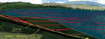
TGA uses Geographic Information Systems (GIS) to develop, manage, and distribute complex spatial databases, and to create presentation-quality visualizations and graphics. We are expert at acquiring and integrating historic and current spatial data to build the critical information you need to facilitate a project or represent a case.
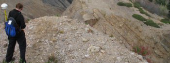
Using GIS, GPS field verification, 3D modelling, and photo simulation we transform complex issues into defensible, authoritative, and easily understood maps and graphics.
Our geometrically correct photo-simulations illustrate what a project will look like during all phases of completion providing concerned residents and officials a true sense of place. These fully rendered simulations are completely defensible and much more provocative than an artist’s sketch.